
One of the great benefits of living in the Valley: the great outdoors are never far away. During pleasant summer and fall weather, many trails exist for hiking, biking, walking or just plain exploring. Check out suggested routes, trail reviews and helpful links with maps available for your convenience below:
COVID-19 Update: During this time please check each location for COVID-19-related closings and details. For trails that are open to visitors, please be respectful of others and follow social distancing guidelines (remain six feet apart from others and be responsible if meeting up with other individuals outside of your household). Various parks and trails in neighboring communities have been closed due to lack of consideration of these policies. Please do your part to help us keep them open!
Essential Guidelines for Safe Trail Use:
** Suggestions made by the Shelton Conservation Committee**
- Always let others know where you are and when you expect to return
- Be aware where hunting is allowed and if hunting season is open (Note: wear bright orange clothing and accessories for extra protection)
- Remain on trails that are blazed
- Cyclists and motorized users must yield to pedestrians and equestrians/pedestrians must yield to equestrians
- Park in designated areas only
- Keep your dogs on a leash at all times
- Respect private property — when you leave state land, you may no longer have permission to recreate
-
Plan your route — view a trail map before beginning your hike (Note: Maps may also be found at trail heads)
Where To Go?
For a high level overview the Naugatuck Valley Council of Governments has put together a searchable map of all trails in the Lower Naugatuck Valley. Read on below to find specific information about various towns and areas.

Shelton
The city of Shelton has a Conservation Committee and a sub-committee focused on trails. This committee has put in the hard work to ensure that the nearly 30 trails throughout the city are continuously being improved. The website is incredibly informative with resources such as maps, history and other information one may find helpful before visiting a trail.
Check out a list of all of Shelton trails here and other helpful resources developed by the Conservation Committee:
Custom Google Map
How to use the Google Map
Out & About COVID Challenge

Naugatuck River Greenway (NRG)
(Ansonia, Derby, Seymour, and Beacon Falls)
The NGR is a state project designed to create open and green spaces along the Naugatuck River. This trail is a non-motorized, multi-use trail currently in development through 11 communities along the river. Check out the completed sections in the area. One popular segment can be found in Derby and Ansonia –starting from the three-quarter mile segment on the side of Division Street belonging to the city of Ansonia, and then continuing 1.7 miles on the side of Division Street belonging to the city of Derby. This way, one can follow the trail all the way to the Derby/Shelton Bridge.

Naugatuck State Forest
(Cheshire, Hamden, Naugatuck, Oxford, and Beacon Falls)
Naugatuck State Forest stretches to nearly 5,000 acres of land and is organized into five blocks: West, East, Mt. Sanford, Quillinan Reservoir and Great Hill. West Rock Ridge Blog provides information regarding the East and West blocks of the property.
Kellogg Environmental Center
(Derby)
As part of the Connecticut Department of Energy & Environmental Protection, the Kellogg Environmental Center offers workshops, exhibits, nature activities and lectures for the general public. Through hands-on programs, families can enjoy learning about nature and the environment. Throughout the year, the Center offers special weekend programs, nature walks, and family workshops. For further information, visit the official website here.
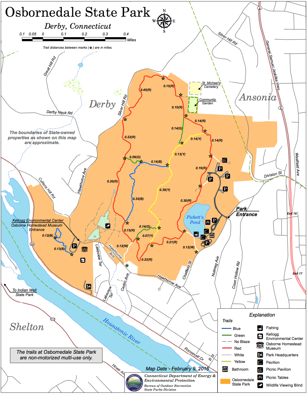
Osbornedale State Park
(Derby)
Osbornedale State Park has over 4.5 miles of trails and another set of unblazed trails used for fishing access along the ponds. Pickett’s Pond dominates the eastern section and is the most common access point for trails. Additional information can be found on the State Park Website Here or at ExploreCT Here.
Headed Outside the Valley?
If you are looking for a longer day trip or to just to explore other parts of the state check out this list of All State Park Information and The Day CT Hiking Guide for other suggestions.
Do you like to bike? Check out the Farmington Canal Trail (FCHT) with over eighty miles of the Farmington Canal Heritage Trail (FCHT) and the eighteen miles of the Farmington River Trail constitute one of the most picturesque and historic greenways in New England. For more information check out FCHT’s Website for more information.
Did we miss any of your favorite spots?
Send us an email at info@fuelthevalley.com and let us know.